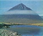
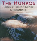
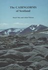
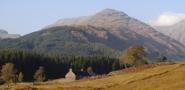
Beinn
Fhionnlaidh ( 3145ft )
|
|

Beinn
Fhionnlaidh ( 3145ft )
|
|
Beinn
Fhionnlaidh ( 3145ft )
|
|
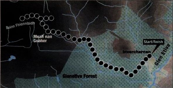
Route Map
for
Beinn Fhionnlaidh
|
|
BEINN FHIONNLAIDH -
ROUTE DESCRIPTION:
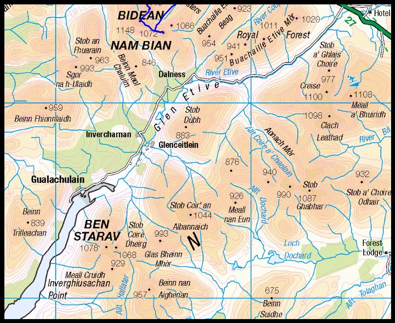
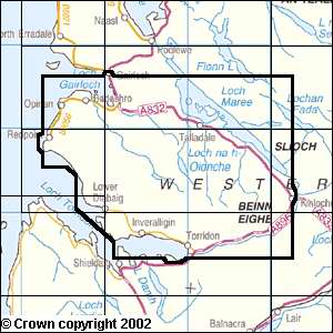
Location: Glen Etive
Map: OS Landranger 50 ( GR095498 )
Distance: 9 miles (14.5km )
Time: 5hours
Terrain: tracks and hillpaths
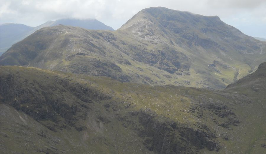
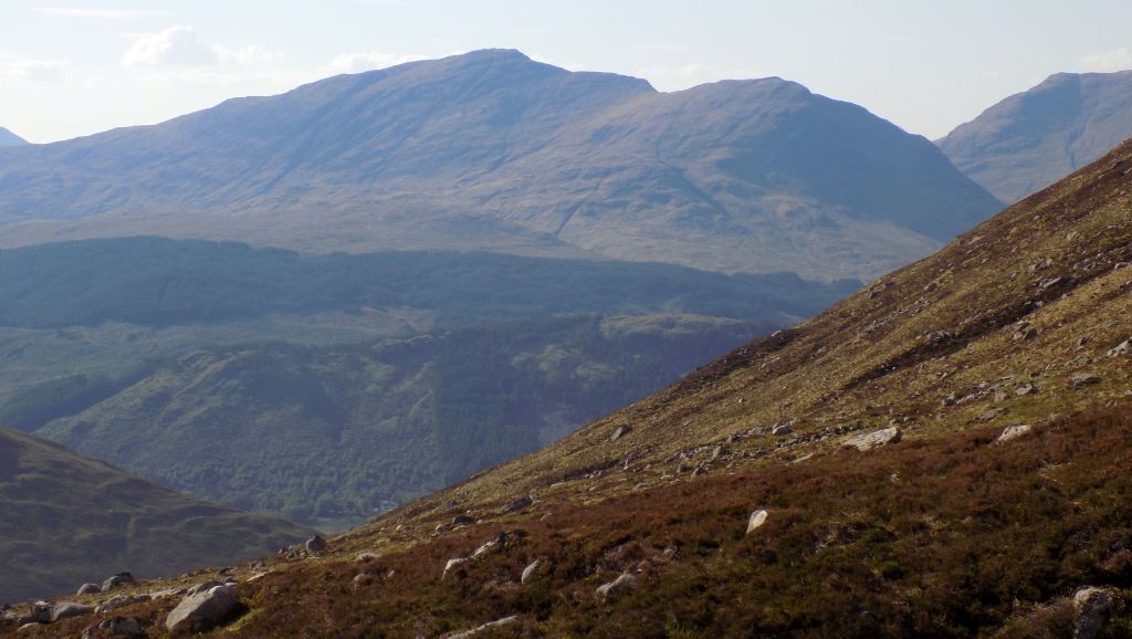
Beinn Fhionnlaidh at
the southern end of Glen Etive is a good objective
for a fine winters
day. Although snowy conditions can be expected on the upper section of
the mountain if not lower down
and the appropriate equipment of ice axe and crampons should be taken,
the route is comparatively straightforward once the Allt Charnan burn
is crossed.
Park near the end of the Glen Etive road at a small
parking area before
the bridge over the Allt Charnan, where the road turns sharply
south-east to Invercharnan. Don't descend to Invercharnan as described
in the
guidebooks but continue straight aheadat the bend on to a new
forestry track built to service weed-cutting operations in the
surrounding forrestry.
This soon joins unto the old track leading from Invercharnan that runs
south-west then north-west through the conifer plantation.
Follow the track for about 1.75 miles ( 3km ) to where it turns sharply
right. On the left, a cairned path — muddy at first and partly obscured
by trees branches off from the main track. Gain this, it soon becomes a
clearer track, and follow it to the open hillside facing Sgor na
h-Ulaidh at the head of the glen and Beinn Fhionnlaidh to the left.
Turn sharp left and
follow a path down to the Allt nan Gaoirean, where there are two
dilapidated log bridges covered with corrugated iron. If the burn is
low it is easily crossed here without the bridges, or slightly further
upstream.
If the burn is in spate then the bridges can be crossed with care; on
hands and knees if the wood is slippery.
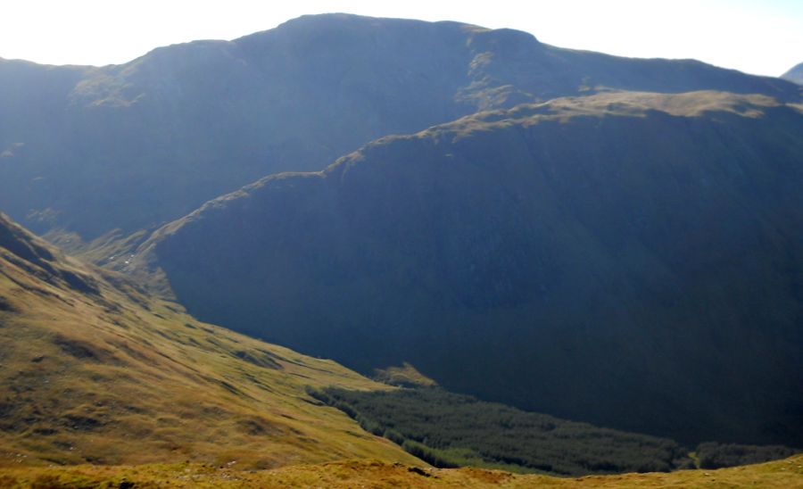
Up ahead a burn descends from a prominent deep rocky gully on the south
face of Meall nan Gobhar. Ascend the path, quite muddy at first,
initially on the left of the burn, then on the right to gain the col
between Meall nan Gobhar and the southern flank of Beinn Fhionnlaidh's
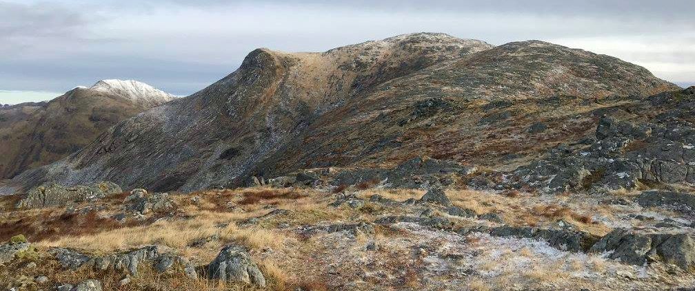
east top.
Zig-zag steeply up on a path of stony quartz then north-west to
gain the ridge between the East Top and main summit, which is marked by
a line of old fence posts, then descend west to the col below the rocky
upper east ridge, where a fence goes left.
Ascend the ridge via a couple at rocky steps, which can be taken direct
or avoided easily to the left, to gain the rocky summit area, from
where the trig point can be seen to the west. It is well worthwhile
continuing along the ridge and taking in the East Top before descending.
However, the volume of boulder scree on the south side of the East Top
means a return to the ascent path on the ridge is a better descent
option than descending directly to the one below Meall nan Gobhar.
|
|
Glencoe
| Knoydart
| Isle
of Skye
| Isle of Arran
| The
West
Highland Way
The
Eastern
Highlands | The Central
Highlands
| The
Southern Highlands | The NW Highlands


Google
Analytics
Google Analytics
extremetracking
extremetracking
Sitelock caingram.com

Sitelock
Sitelock caingram.info

Sitelock

 ::
Glencoe Photo
Gallery
::
Glencoe Photo
Gallery