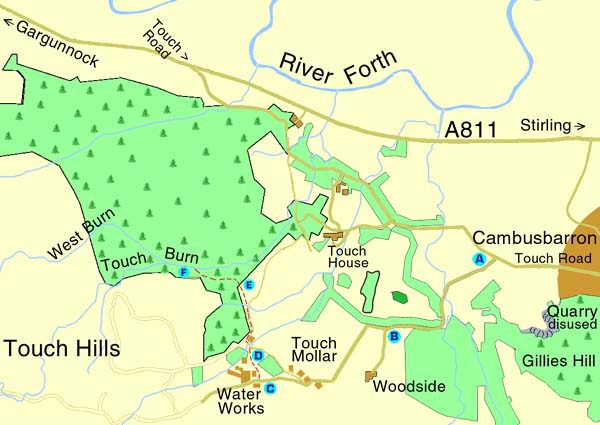
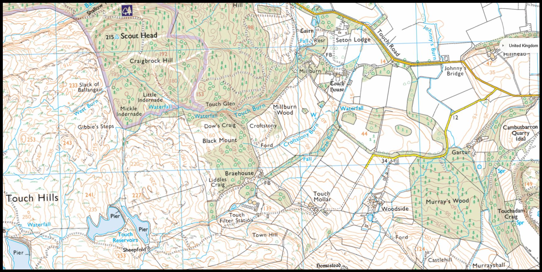
At the T-Junction on
Main Street in Cambusbarron, make your way out of the village on the
Touch Road. Continue past sign to Cambusbarron
Quarry and turn left after entrance to Gartur Estate.
At the
point where the road divides. Do
not take the signposted road to Brooklands and Woodside. Keep
to the right and follow the road up the hill. There are cattle grids
and sheep wandering on the road. Eventually,
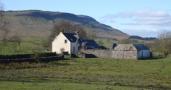
you see some cottages on your left and waterworks in front of you.
Walk
down, alongside the waterworks, past the old wooden
scout hut. As you round the corner into a small, enclosed field ,
there are old railway sleepers over a patch which can be boggy. Look
over the dry stone dyke to get a great view of Stirling Castle and
the Carse.
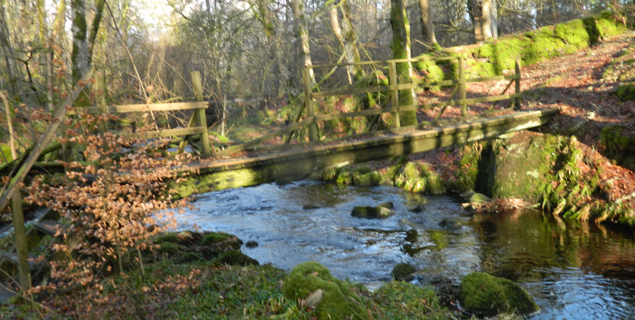
Go
through the gate and you will see a track
winding around to the left of the farmhouse. Follow the track and
remember to close any gates behind you. The track starts to wind it's
way down the hill but keep heading straight towards the trees ahead
of you. Climb over or go under the fence , then make your way into
the trees. You
will see and hear Touch Burn in the gully and
should be able to find a path. Sections of the path are fine but it
tends to disappear in places. The path gets covered in fallen leaves
and can be slippery. This part of the walk can be dangerous so be
careful and keep a close watch on children.
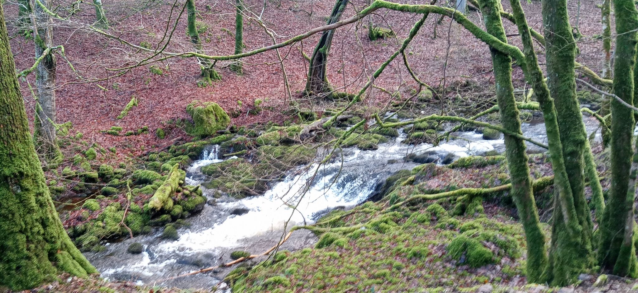
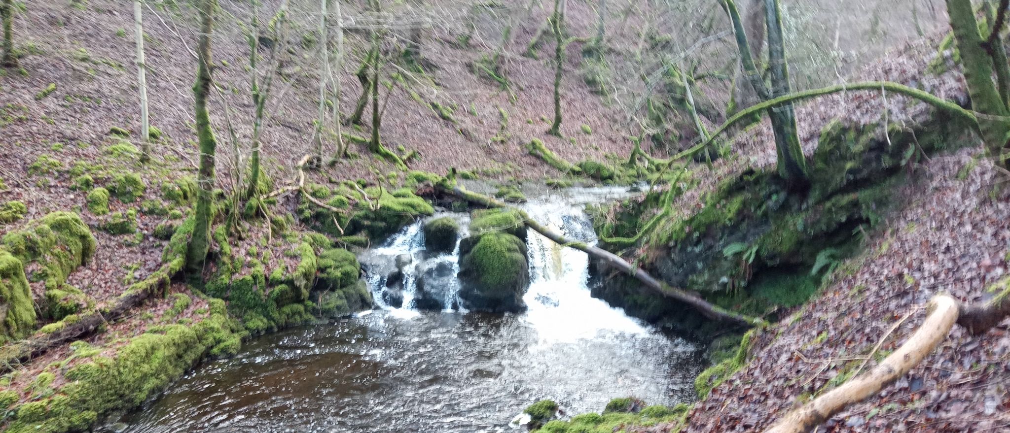
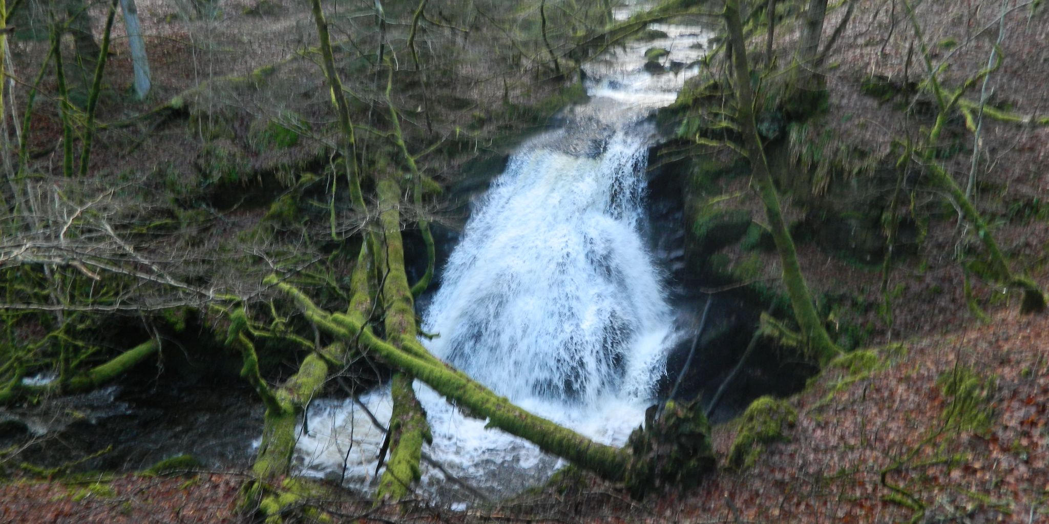
You
will see some
smaller waterfalls and on the lower stretch of the burn you can get
down to the water. Keep walking upstream and don't be tempted to
climb down. Be very careful as the burn flows deep through the gorge
and the path runs very close to the edge. The
path is hard to
follow in places but keep going until you come to a row of trees
rooted on an old dry stone dyke. Up on the left you will see a line
of trees and a wire fence running along by the dyke. Proceed to the
right, along the line of the dyke and then carefully make your way
down to the burn.
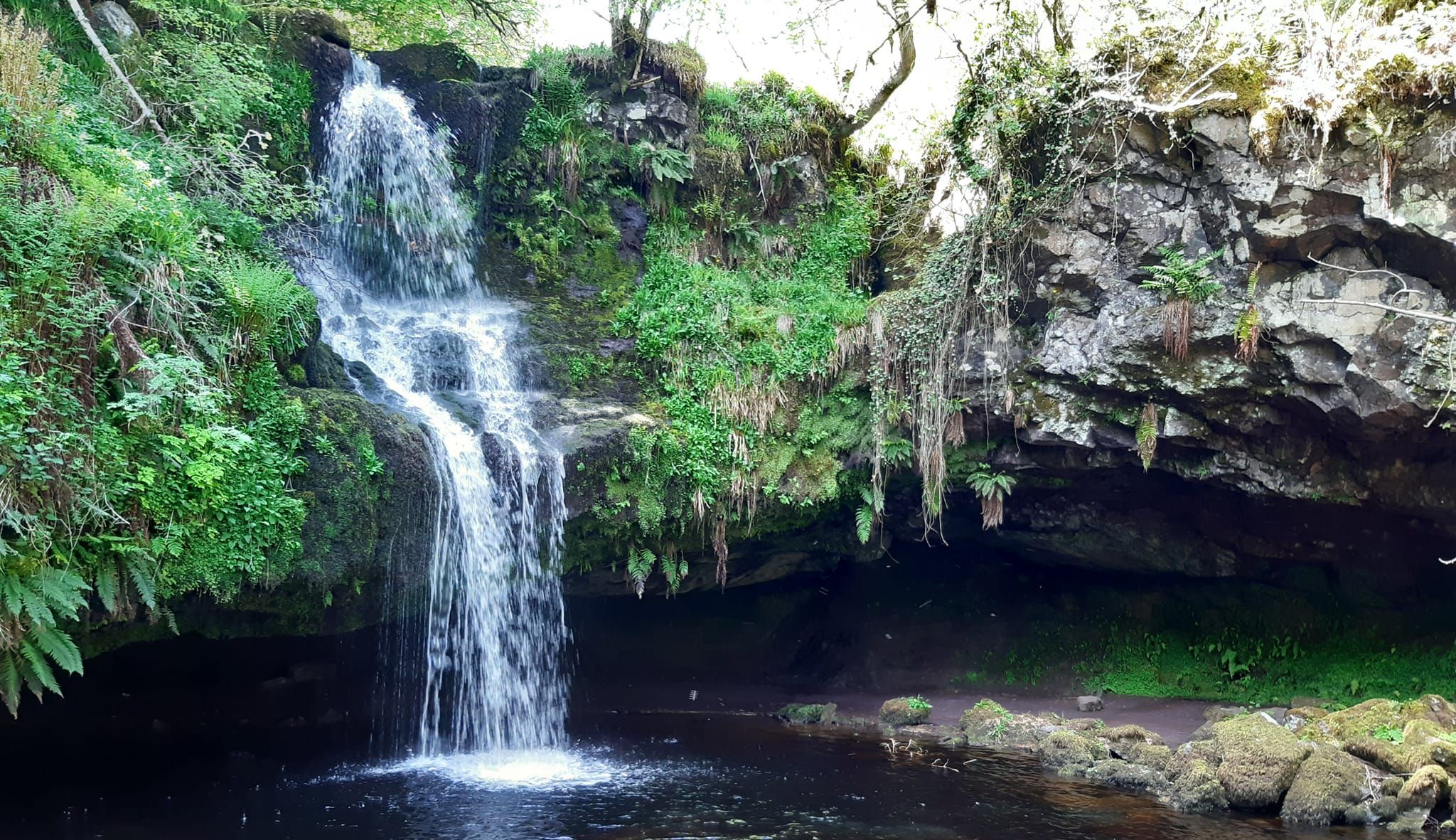
Care
should be taken while descending as
the bank is steep and covered in loose material. If the burn isn't
flowing too fast, you can make your way across the stepping stones to
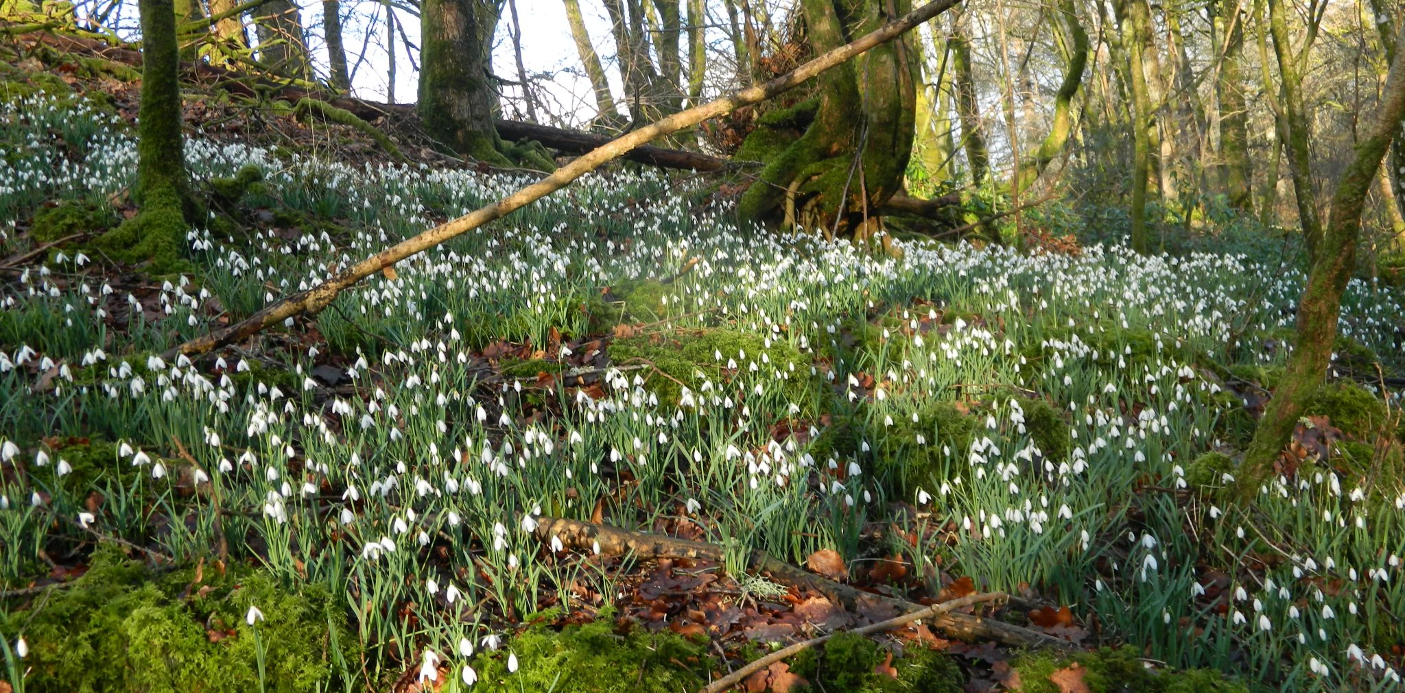
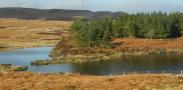
explore Gilmour's Linn, a peaceful place to spend some time. This
scenic waterfall has a deep cave running behind it and Bonnie Prince
Charlie is reputed to have hidden here when fleeing after the Battle
of Culloden.


 :: Gargunnock Hills
Gallery
:: Gargunnock Hills
Gallery