DISTANCE: 4.5 miles / 7km
TIME: 3 HRS
WAYMARKED: N0
MAP: OS 23
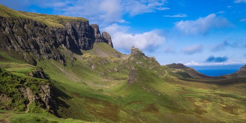
Few treasure hunts reveal a prize
so intriguing as the Quiming’s secret inner sanctum.
Reaching heavcnwards this
grassy plateau could be the playing field of the gods.
Only they surely could provide such a hiding place.
Now, though, some have discovered the secret and
each New Year's Day the local men haul themselves up the
hill to stage a
traditional game of shinty here. Fun for everyone
except the poor soul assigned to retrieve the lost balls.
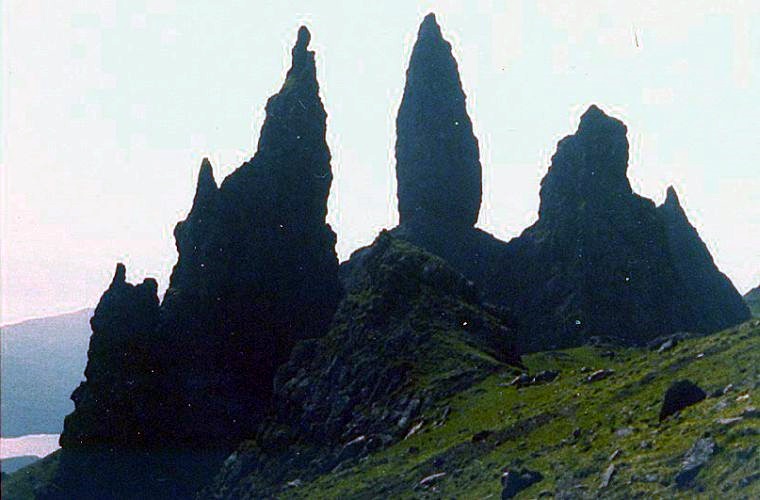
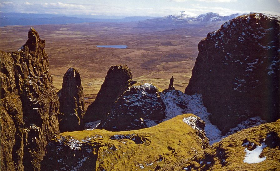
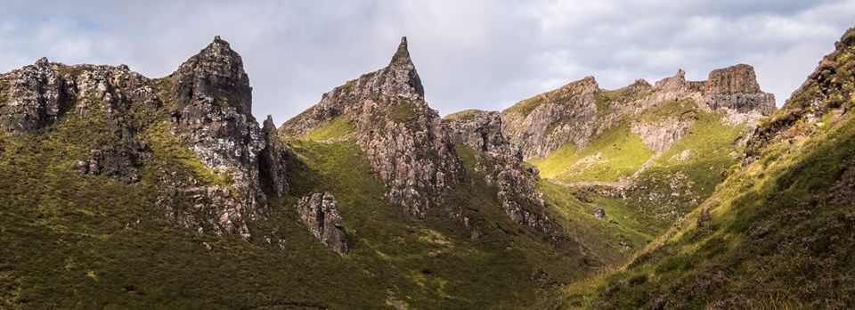
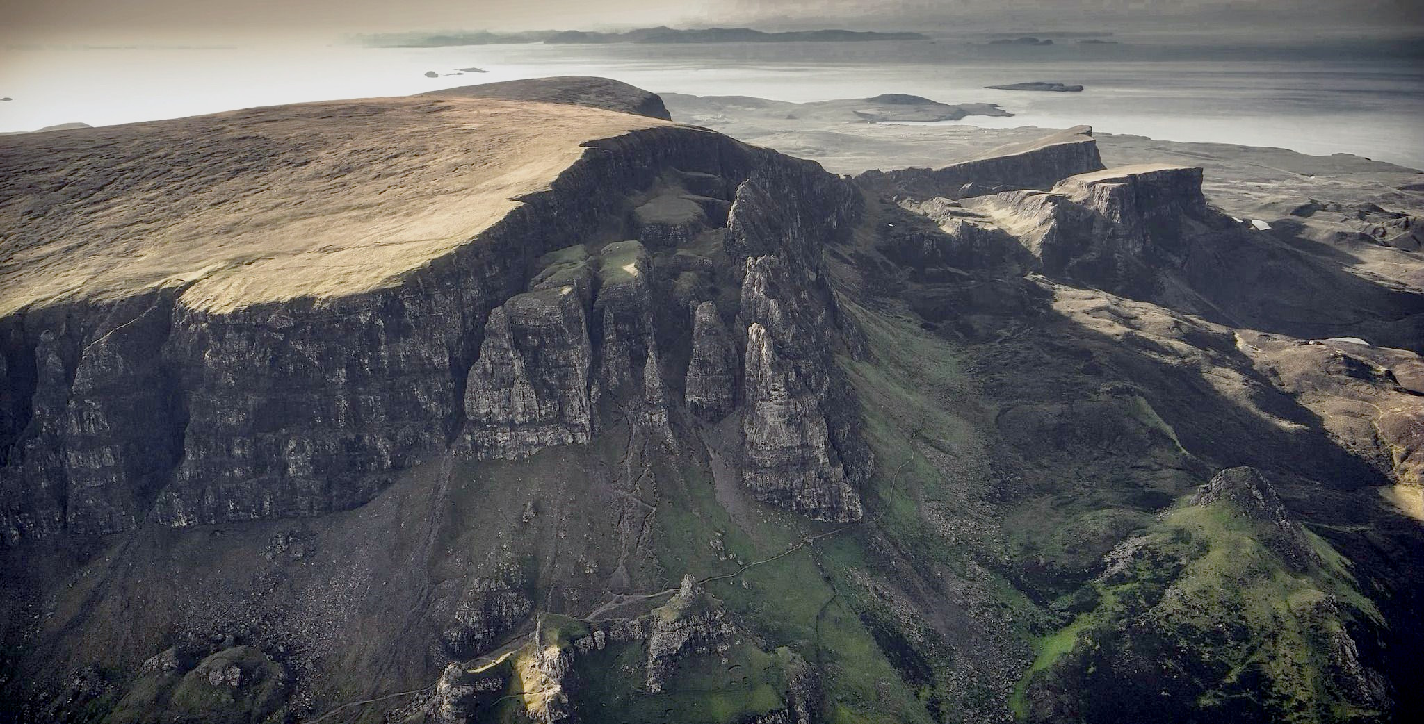
The first challenge at this extraordinary geological
site is finding The Needle - the pinnacle guarding the
narrow entrance to The Table.
The second is climbing the steep scree-covered
slope to The Needle, then you enter a claustrophobic rock
amphitheatre dwarfed on all sides by vcrtiginous
spires and verdant walls. lt is a bizarre tranquil
cathedral.
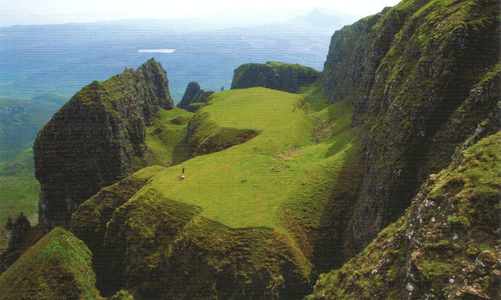
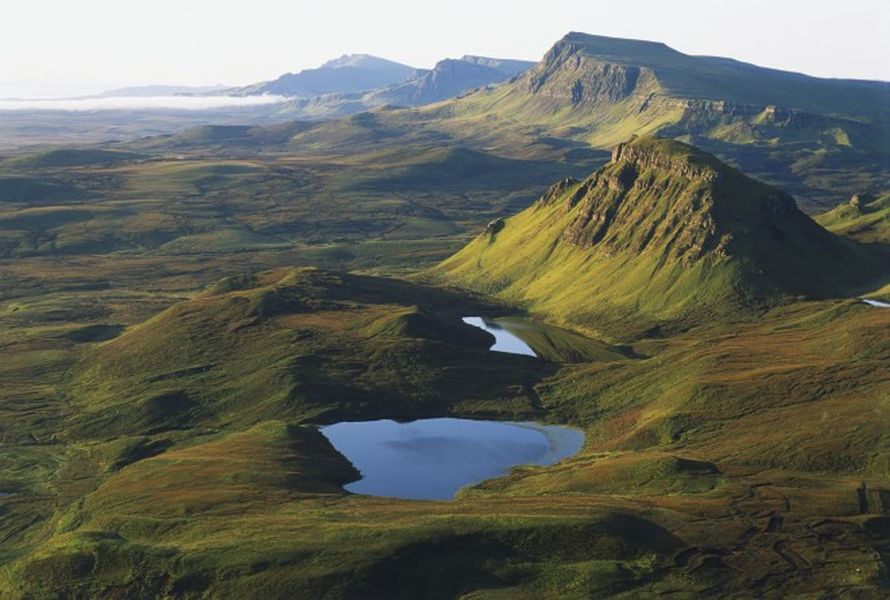
Continue on the path behind The Needle and you reach
The Table, flat and grassy. The Table is actually part of the
gigantic Flodigarry landslip caused by the basalt lava
beds slipping over dolerite sills in underlying jurassic
sediments.
The view down onto The Table from above should not be
missed - especially by anyone arrogant enough
in doubt of thc creative power of nature.
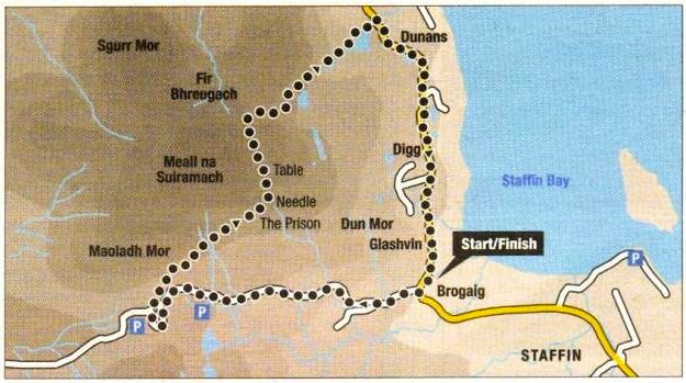
HOW TO GET THERE:
From Portree follow the A855 north below the long Trotternish
escarpment and past pinnacle of The Old Man of Storr to Staffin.
At Brogaig follow the minor road to Ung to the car park at
its highest point.
ACCOMMODATION:
Skye teams with tourist facilities, but on the east coast the
Glenview Inn [ D1670 562268 ] (also
with campsite ), the Flodigarry Country House Hotel [ OM70
552203 ] and the Dun Flodigarry Backpackers' Hostel (D1670
552212 ) come recommended.
WHERE TO EAT: The Glenview Inn is praised. At Uig try the
Pub at the Pier, or the Duntulm Castle Hotel in
Duntulm.
OTHER THINGS To Do: Kilt Rock and the waterfall are seen
from road south of Staffin.
Fossilised dinosaur footprints in Slaffin Bay. At Flodigarry
is Flora Macdonalds cottage.
The Storr, Walemish Point west of Uig and Dunvegan
Castle and Neist Point in the west are all worth a visit.
Tourist Information:
Portree ( 01478 612137 ), Broadford (
OM71 B22361 ).
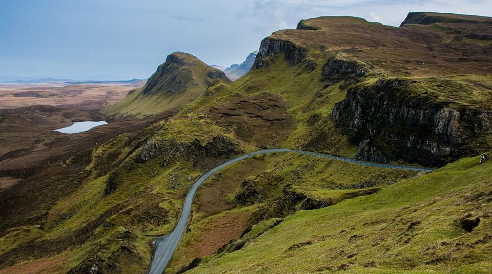
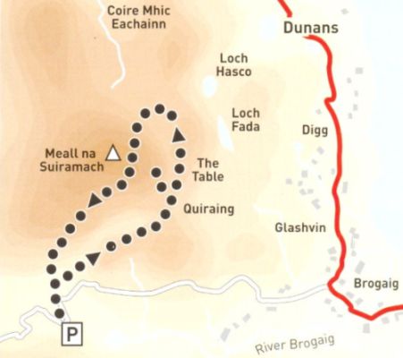
Access Route:
A path from the car park on the Staffin to Uig road
leads north-east beside the escarpment to arrive at The
Prison,
the first rocky peak on the right.
Up and left is the impressive pinnacle of The Needle.
2. Ascend the steep slope and pass to the left of The
Needle.
3. Return to the main path, turn left, and ascend to gain
the ridge west of Leac nan Fionn and a stile.
4. Turn left and carefully follow the path above the
escarpment south towards Meall na Suiramach, then
south-west to the car park.